Wadi A-3
Anonymous

Entryway A
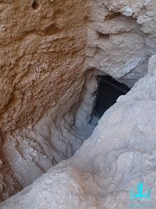
See entire tombA deep shaft cut into the terrace along the cliff leads down to a chamber.
Chamber B
See entire tombThis chamber lies along the entrance's axis and is only partially visible from the shaft. It may be that either the excavation of this chamber was abandoned or it is blocked by very hard debris.
About
About
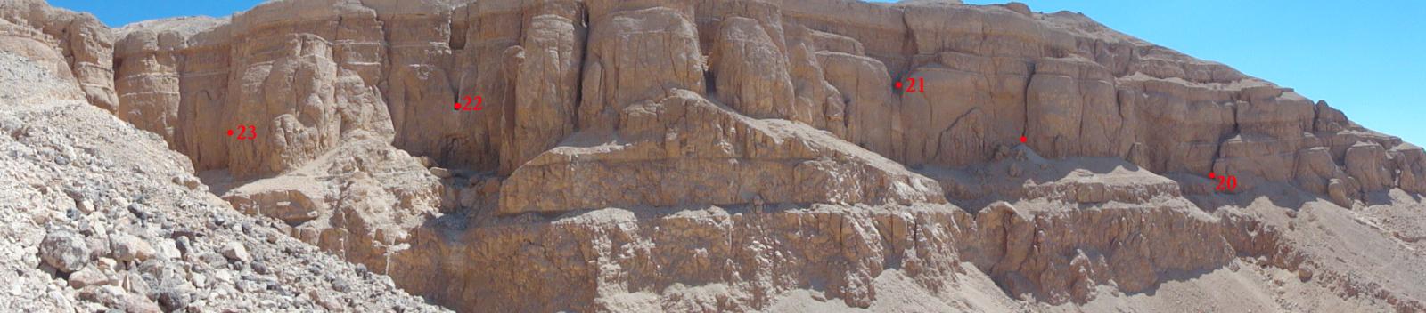
Wadi A-3 is located below the cliff at the end of a tributary branch of Wadi Jabbanat Al-Qurud called Wadi Sikkat Taqat Zayid (Howard Carter’s Wadi A). It is cut into a crevice of the terrace below Baraize’s cliff tomb (Wadi A-2) and consists of a shaft entrance (A) that leads into a chamber (B). The latter is only partially visible and it may be that either the tomb was abandoned during excavation or is blocked by very hard debris.
The tomb was not noted by Howard Carter during his survey of the Western Wadis in 1916-1917. Elizabeth Thomas surveyed and mapped it in 1959-1960, followed by the Theban Mapping Project in 1982. The last survey was conducted by the joint expedition of the New Kingdom Research Foundation and The Cambridge Expedition to the Valley of the Kings in 2013-2014. Due to its close proximity to Hatshepsut’s cliff tomb (Wadi A-1) and Baraize’s cliff tomb (Wadi A-2), Wadi A-3 has been dated to the 18th Dynasty.
Noteworthy features:
Wadi A-3 is cut into a crevice of a terrace below the cliffs of Wadi A. It is not certain whether the tomb was abandoned or whether the lower chamber is blocked by very hard debris.
Site History
The tomb was constructed in the 18th Dynasty and possibly abandoned during excavation.
Dating
This site was used during the following period(s):
Exploration
Conservation
Site Condition
The tomb currently stands open and is in danger of being reburied by debris falling from the cliff or carried in by flooding.

Articles
Tomb Numbering Systems in the Valley of the Queens and the Western Wadis
Latest Discovery in Wadi C (2022)
Geography and Geology of the Valley of the Queens and Western Wadis
Bibliography
Lilyquist, Christine with contributions by James E. Hoch and A.J. Peden. The Tomb of Three Foreign Wives of Tuthmosis III. New York: The Metropolitan Museum of Art, 2003.
Litherland, Piers. The western wadis of the Theban necropolis: a re-examination of the western wadis of the Theban necropolis by the joint-mission of the Cambridge Expedition to the Valley of the Kings and the New Kingdom Research Foundation, 2013-2014. London: New Kingdom Research Foundation, 2014.
Thomas, Elizabeth. The Royal Necropoleis of Thebes. Princeton: privately printed, 1966.
