KV 24
Unknown

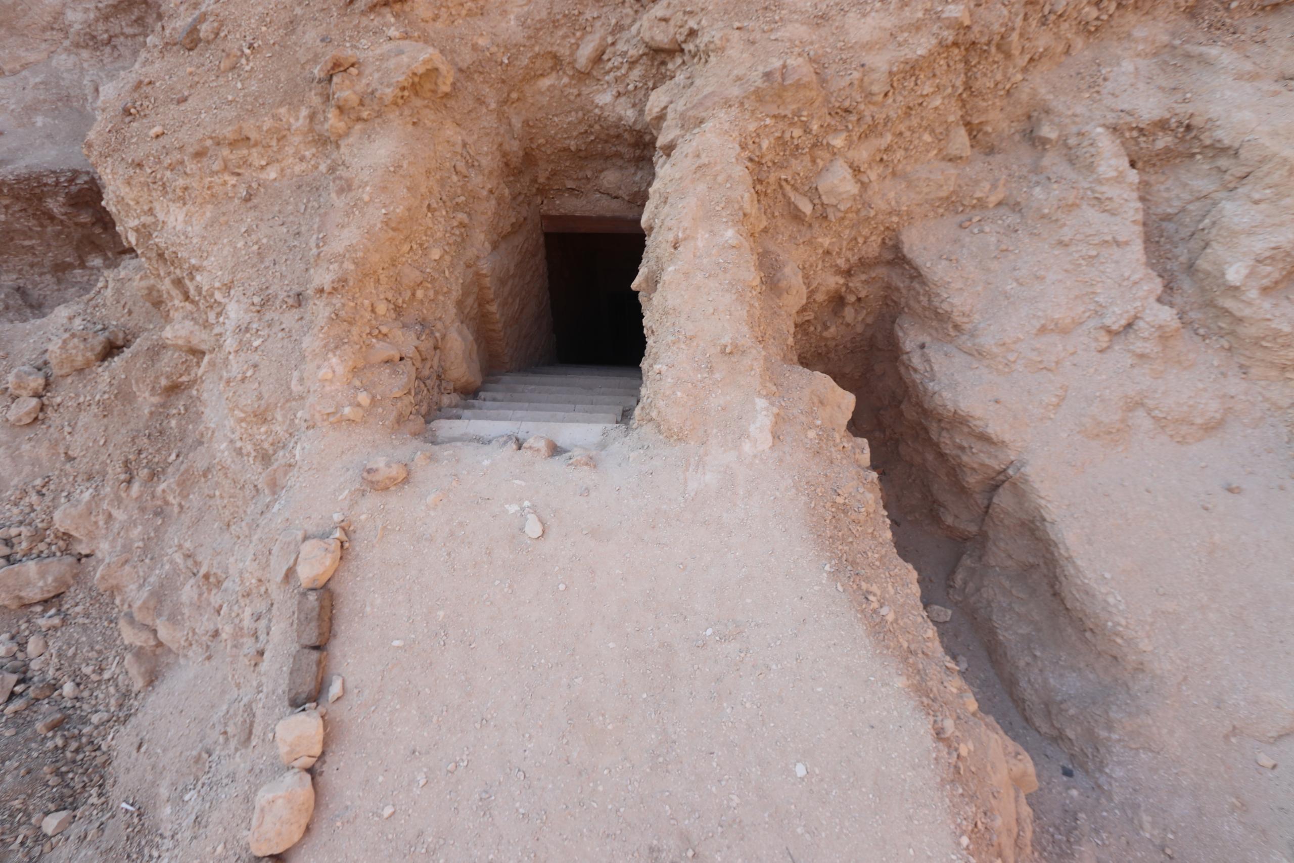
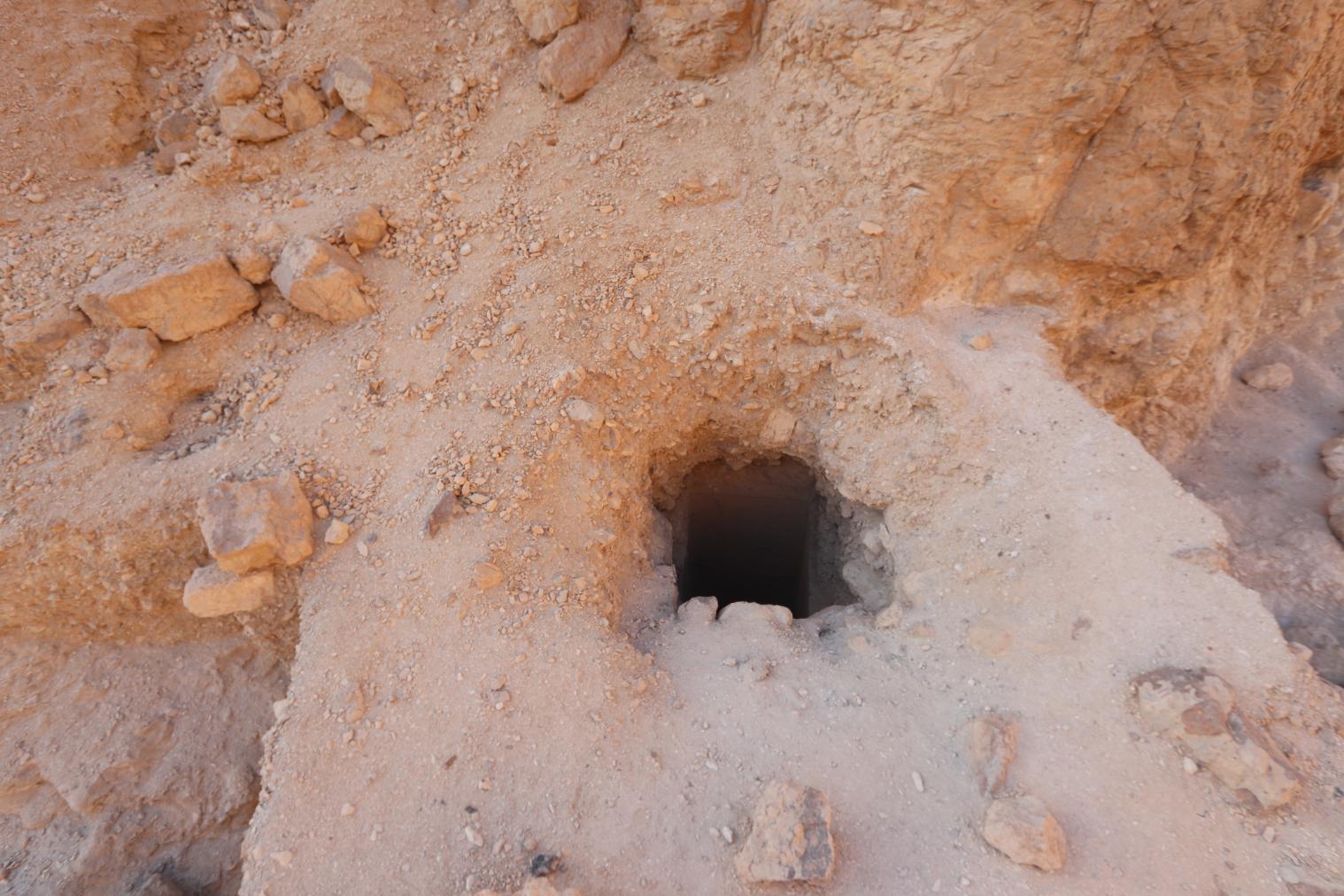
Entryway A
See entire tombThe entrance shaft is well-cut, but its upper part is irregular.
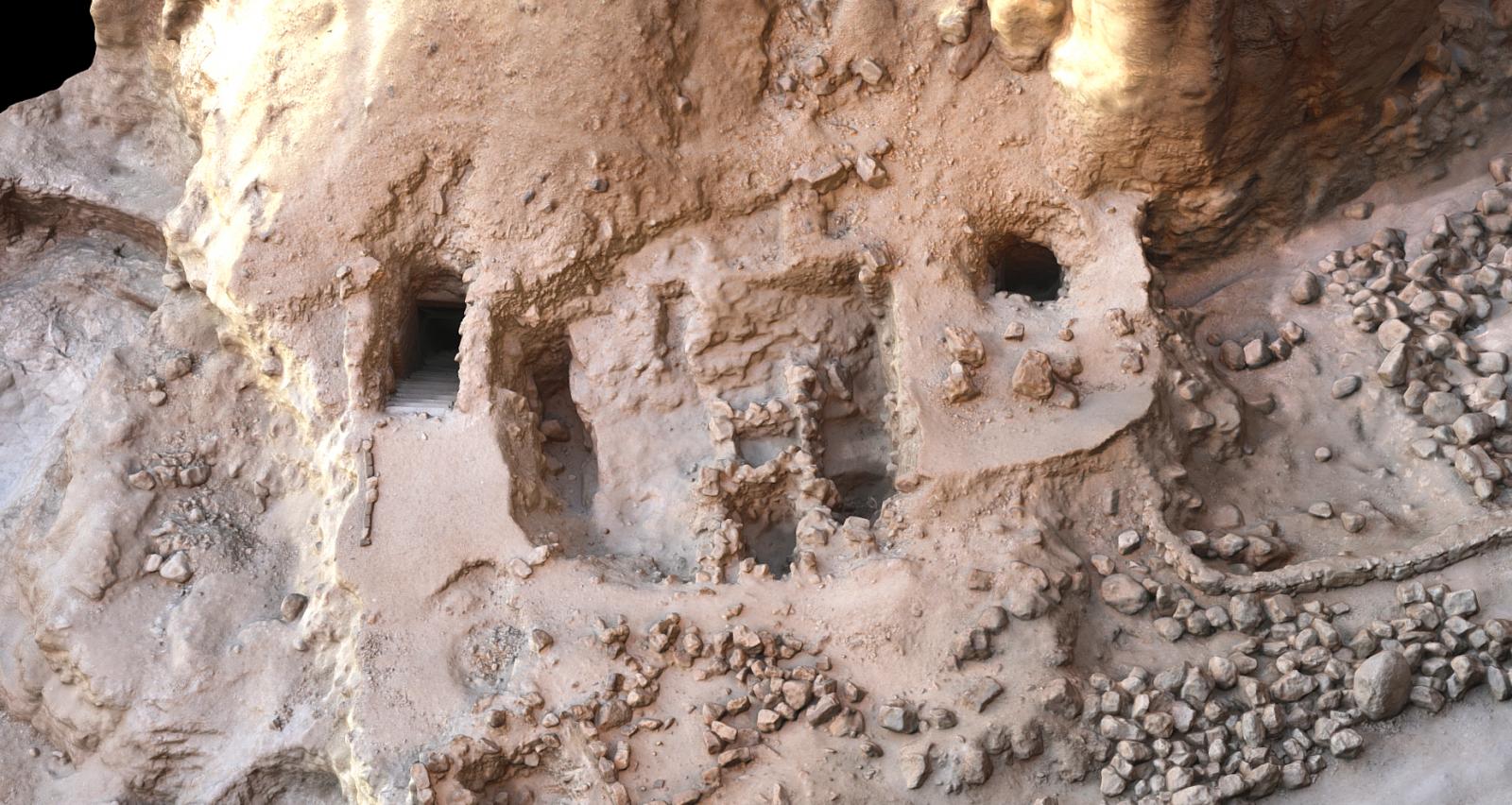
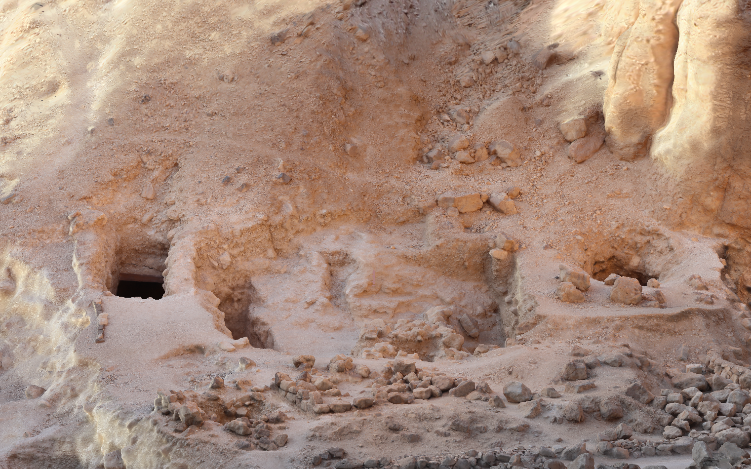
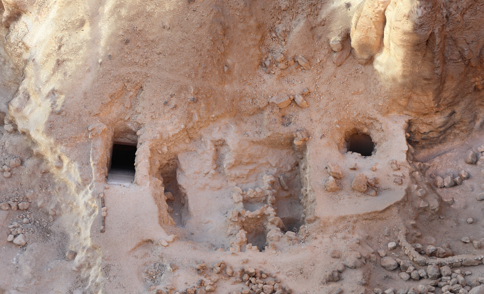
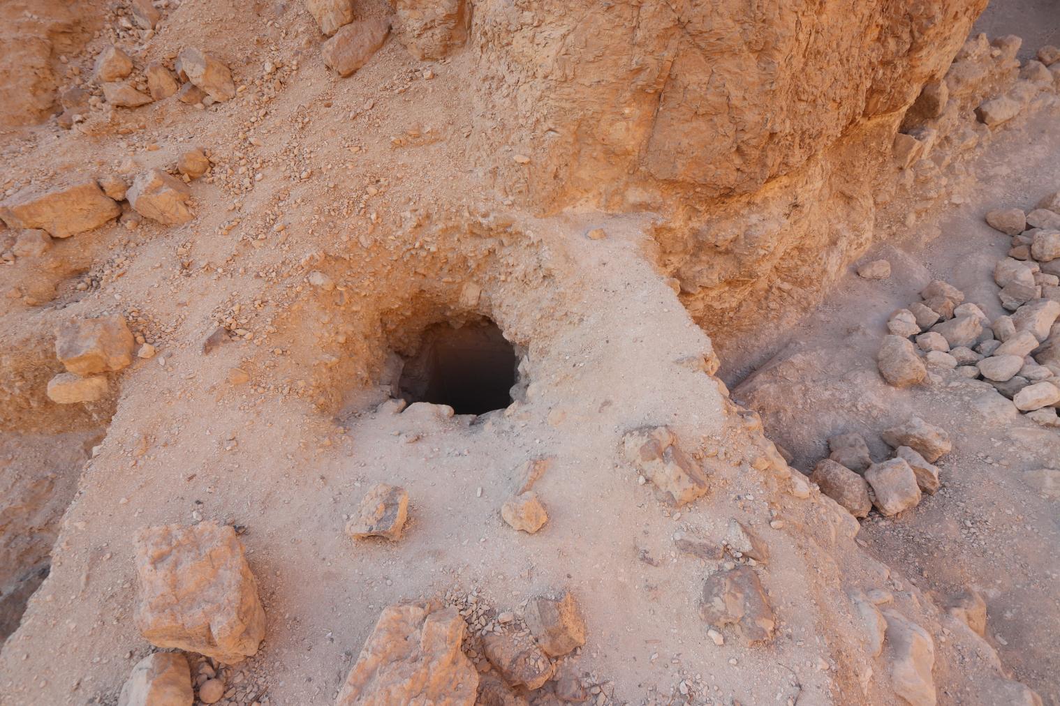
Gate B
See entire tombThe gate is well cut. It lies in the southwest side of the shaft, entryway A.
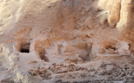
Chamber B
See entire tombThe front (northeast) wall and most of the right (northwest) wall are well-cut. The irregular shape of the left (southeast) and rear (southwest) walls indicate that the cutting was left unfinished. A fault in the rock running diagonally from the east to the west corner led Schaden to speculate that it was an intentional cut. Schaden cleared limestone chips left by ancient workers which covered the floor.
About
About
The tomb lies at the end of the West Valley, a short distance from KV 25. It is a tomb of non-royal design and consists of a deep rectangular shaft (A) and a very rough rectangular chamber (B). The tomb was cut into the floor of the Wadi at the base of a slope. The first part of the shaft cut through the hard-packed surface of the valley floor; the rest and the chamber were cut in the underlying rock.
Noteworthy features:
This tomb is unfinished and non-royal.
Site History
Evidence for a royal burial in this tomb is lacking. Artifacts and the tomb's location indicate that it was cut in Dynasty 18. The presence of artifacts from this period through the late Roman and Coptic periods indicates that the tomb was reused a number of times. Intrusive burials (human remains of at least five different persons) from Dynasty 22 were found. The tomb was visited repeatedly in ancient and modern times, as shown by a disruptions in the stratigraphic layering of flood debris and by discarded objects.
Dating
This site was used during the following period(s):
Exploration
Conservation
Site Condition
When discovered, the tomb was full of debris, much of it chips from the cutting of the tomb. Other debris was deposited by floods. Wasps occupied the tomb and have left concrete-like nests on the walls and ceiling. The tomb was excavated by Schaden.


Articles
History of the Valley of the Kings: Third Intermediate Period to the Byzantine Period
Anatomy of a Tomb: Ancient and Modern Designations for Chambers and Features
Bibliography
Aubriot, L. and M. Kurz. Graffiti de la montagne thébaine: Plans de position. Cairo: Centre du Documentation et d’Etudes sur l’ancienne Egypte, 1971. Plan 101.
Cerný, Jaroslav and A. A. Sadek. Graffiti de la montagne thébaine. III: 3. Cairo: Centre du Documentation et d’Etudes sur l’ancienne Egypte, 1971. pl. 101.
Helck, Wolfgang. Königsgräbertal. Wolfgang Helck, Eberhart Otto and Wolfhart Westendorf (eds.). Lexikon der Ägyptologie. 7 vols. Wiesbaden, 1972-1992. 3: 519.
Mastenbroek, O. Archeologisch nieuws, no. 8: Het Dal der Koningen. De Ibis 19 (1994): 16-20.
Reeves, Carl Nicholas. Valley of the Kings: The Decline of a Royal Necropolis (= Studies in Egyptology). London: KPI, 1990. Pp. 154.
Schaden, Otto J. Preliminary Report on Clearance of WV24 in an Effort to Determine Its Relationship to Royal Tombs 23 and 25. KMT 2/3 (1991): 53-61.
Schaden, Otto J. Tutankhamun-Ay Shrine at Karnak and Western Valley of the Kings Project: Report on the 1985-1986 Season. Newsletter of the American Research Center in Egypt 138 (1987): 10-15.
Thomas, Elizabeth. The Royal Necropoleis of Thebes. Princeton: privately printed, 1966. P. 163.
Weeks, Kent R. (ed.). Atlas of the Valley of the Kings (= Publications of the Theban Mapping Project. Cairo: American University in Cairo, 1). Cairo: American University in Cairo Press, 2000. Map sheet 46.