KV 31
Unknown

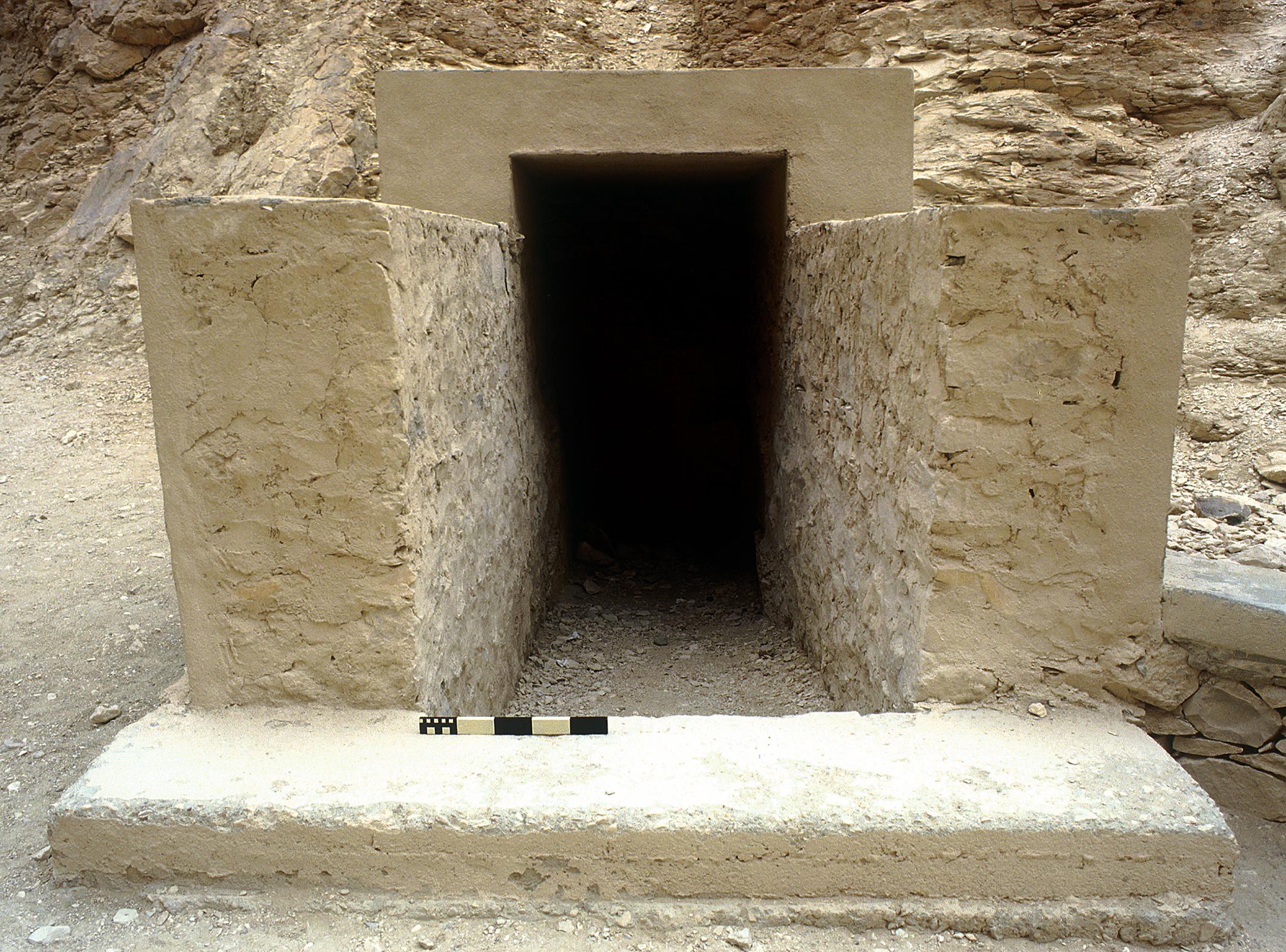
Entryway A
See entire tombThe tomb lies in the talus about 20 m (66 feet) below KV 32. Thomas suggested that the unusual proportions of the entrance shaft indicate that KV 31 could be a small corridor tomb, but no details are available.
Chamber B
See entire tombChamber C
See entire tombChamber D
See entire tombAbout
About
The tomb is accessible through a steep vertical shaft and lies about 20 meters (66 feet) north of KV 32. Upon being cleared in 2010 it was observed to be undecorated, but was filled with ancient debris that included large quantities of pottery shards and some pieces of Canopic jars. Five mummies, unwrapped and without coffins, were also found inside the tomb in a poor condition. The identities of the mummies is unknown, but it is likely that they were family members of the royal family or of a similar high social status. The mummies were all reassembled, studied, and radiological images were taken in situ using a portable X-ray unit.
Noteworthy features:
A total of five human mummies were found inside the tomb after it was cleared, two female and three male.
Site History
KV 31 could have been the original location of a Dynasty 18 quartz-sandstone anthropoid Sarcophagus found by Belzoni in 1817 and donated to the British Museum by the Earl of Belmore.
Dating
This site was used during the following period(s):
Exploration
Conservation
Conservation History
The tomb was consolidated and mapped by the University of Basel between 2010 and 2012, after they finished clearing it of modern and ancient debris. Theirs is the first known plan of the tomb.
Site Condition
The tomb was completely filled with debris until it was cleared by a mission from the University of Basel "King's Valley Project" (formerly known as "MISR: Mission Siptah-Ramses X") beginning in 2010.
Articles
Anatomy of a Tomb: Ancient and Modern Designations for Chambers and Features
Bibliography
Helck, Wolfgang. Königsgräbertal. Wolfgang Helk, Ebrnart Otto and Wolfhart Westendorf (eds.). elck, Evbermnart Lexikon der Ägyptologie, 3. Wiesbaden: Harrassowitz, 1980. Pp. 520.
Reeves, Carl Nicholas. Valley of the Kings: The Decline of a Royal Necropolis (= Studies in Egyptology). London: KPI, 1990. Pp. 167.
Thomas, Elizabeth. The Royal Necropoleis of Thebes. Princeton: privately printed, 1966. P. 157.
Weeks, Kent R. (ed.). Atlas of the Valley of the Kings (= Publications of the Theban Mapping Project, 1). Cairo: American University in Cairo Press, 2000. Map sheet 47.
Wilkinson, Richard H. and Carl Nicholas Reeves. The Complete Valley of the Kings. London: Thames and Hudson, 1996. P. 183.